7 NCDOT Traffic Numbers That Explain Why U.S. 17 Feels Overloaded
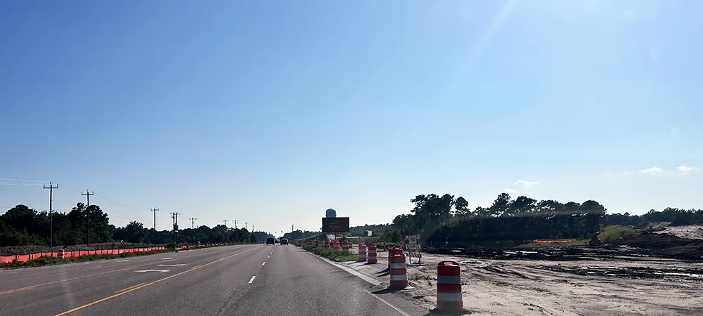

If you drive U.S. 17 between Wilmington, Scotts Hill, Hampstead, Holly Ridge, Sneads Ferry, or Jacksonville, you do not need a traffic study to know the road feels different than it used to.
The backups feel more common. School-day slowdowns feel heavier. Beach-season traffic feels less like a temporary inconvenience and more like part of the normal routine.
But the numbers help explain what locals are feeling. Traffic counts along key parts of the U.S. 17 corridor show steady growth over the last 10 to 15 years, especially near Hampstead, Scotts Hill, Porters Neck, Sneads Ferry, and the Jacksonville approach.
This is not just a “traffic is bad” story. It is a look at seven numbers that help explain why U.S. 17 feels more overloaded than it used to.
Quick take
U.S. 17 is not just having a few bad traffic days. The reviewed traffic counts show several key stretches carrying roughly 40% to 50% more daily traffic than they did around 2010.
The biggest standout: near Scotts Hill and Porters Neck, U.S. 17 is now approaching 50,000 vehicles per day, roughly 15,000 more than in 2010.
7 numbers that explain the strain
- Scotts Hill has added about 15,000 vehicles a day since 2010.
- Hampstead’s main crossroads is carrying nearly 50% more traffic than in 2010.
- Sloop Point Loop Road has added about 10,000 vehicles a day since 2010.
- Summer can drop another 4,500 vehicles a day onto U.S. 17 through Pender County.
- Sneads Ferry and Holly Ridge are seeing Hampstead-level growth.
- Jacksonville’s U.S. 17 approach still carries about 40,000 vehicles a day.
- The real surprise: U.S. 17 is carrying more than commuters.
How We Looked at the Data
This review uses Annual Average Daily Traffic, or AADT, from NCDOT traffic count station data and related planning documents.
AADT estimates the average number of vehicles using a road each day. It is not a perfect snapshot of one bad Monday morning, one Friday beach turnover, or one crash-related backup, but it is useful for seeing how daily demand has changed over time.
The checkpoints below are best-fit U.S. 17 locations in New Hanover, Pender, and Onslow counties near familiar local pressure points. Some station years are missing or listed as provisional in the source research, so the figures below use rounded values and avoid filling in missing data.
1. Scotts Hill Has Added About 15,000 Vehicles a Day Since 2010
The largest raw increase in the review shows up near Scotts Hill and Porters Neck.
U.S. 17 traffic there rose from roughly 33,000 vehicles per day in 2010 to about 48,000 in the latest available count.
That means this stretch is handling about 15,000 more vehicles every day than it did around 2010.
For locals, this explains a lot. That stretch is no longer just a northern approach into Wilmington. It now carries Pender County commuters, Porters Neck and Scotts Hill traffic, Wilmington-bound trips, beach traffic, delivery traffic, and regional pass-through traffic all at once.
When that many trips stack onto one corridor, a small disruption can quickly turn into a noticeable backup. A crash, lane shift, slow signal cycle, or school-related slowdown does not have much room to absorb itself.
2. Hampstead’s Main Crossroads Is Carrying Nearly 50% More Traffic Than in 2010
The biggest percentage jump shows up near one of Hampstead’s most familiar choke points: U.S. 17 and N.C. 210.
The reviewed station rose from roughly 25,000 vehicles per day in 2010 to about 37,000 in the latest available count. That is about a 48% increase.
This number matters because N.C. 210 is not just another intersection. It connects Hampstead, Surf City, Topsail Island, local neighborhoods, schools, shopping centers, and commuter routes toward Wilmington and Jacksonville.
It also helps explain why traffic discussions around Hampstead have become so intense. The corridor is adding commercial activity while major infrastructure work is still catching up. That same pattern shows up in recent local development coverage, including the broader look at new businesses and development along U.S. 17 in Hampstead.
For a local driver, this is one of the clearest “this is not in your head” numbers in the whole corridor.
3. Sloop Point Loop Road Has Added About 10,000 Vehicles a Day Since 2010
Near Sloop Point Loop Road, U.S. 17 added almost another town’s worth of daily traffic.
The reviewed station increased from roughly 24,000 vehicles per day in 2010 to about 34,000 in the latest available count. That is about 10,000 more vehicles per day near one of Hampstead’s most familiar pressure points.
This location matters because it is tied closely to the Topsail schools complex, nearby neighborhoods, local businesses, and short local trips. It is not only commuters passing through. It is parents, buses, students, teachers, contractors, delivery vehicles, and regional traffic all sharing the same road.
The Sloop Point area is also where development stories tend to get local attention, including the planned Wawa site along U.S. 17 and Sloop Point Loop Road. Whether residents are excited, skeptical, or just tired of turning lanes and site work, the traffic context matters.
A road segment that adds roughly 10,000 daily vehicles does not feel the same, even if the route number on the sign has not changed.
4. Summer Can Drop Another 4,500 Vehicles a Day Onto U.S. 17 Through Pender County
Even after accounting for year-round growth, summer adds another layer.
Pender County planning materials cited in the research estimate that peak summer traffic can add roughly 4,500 vehicles per day to U.S. 17 through Pender County.
That is on top of the normal commuter base.
This is why local traffic pressure can feel different from regular suburban congestion. U.S. 17 has the year-round growth problem first. Then summer adds vacation rentals, day-trippers, boaters, restaurant traffic, beach supply runs, and weekend turnover traffic.
That same seasonal pressure shows up farther onto the island too. We recently covered how traffic picked up across Topsail Island before peak summer had even arrived, with backups forming around the Surf City bridge and nearby traffic circles.
For a local trying to get to work, make a school pickup, reach a doctor’s appointment, or cross the bridge, those seasonal trips are not abstract tourism numbers. They are cars in the same turn lanes, at the same signals, and on the same limited routes.
5. Sneads Ferry and Holly Ridge Are Seeing Hampstead-Level Growth
The growth story does not stop at Hampstead.
Near Holly Ridge and Sneads Ferry, the reviewed U.S. 17 station north of N.C. 172 rose from roughly 20,000 vehicles per day in 2010 to about 29,000 in the latest available count.
That is about 9,000 more vehicles per day, or roughly 45% growth.
This part of the corridor has its own traffic mix: Camp Lejeune commuting, Sneads Ferry residential growth, beach-related traffic, school trips, local shopping, and people moving between Onslow County and the Topsail area.
The takeaway is simple: U.S. 17 is not tightening in one isolated spot. Growth is showing up across multiple communities along the corridor.
That matters because traffic pressure compounds. A driver may feel the backup in Hampstead, but the demand feeding that backup can start miles away.
6. Jacksonville’s U.S. 17 Approach Still Carries About 40,000 Vehicles a Day
Even where bypass infrastructure has already changed traffic flow, the daily volume remains heavy.
On the Jacksonville approach near the U.S. 17 Business split, traffic increased from roughly 29,000 vehicles per day in 2010 to about 40,000 in the latest available count.
That is about 11,000 more vehicles per day, or roughly 38% growth.
The research notes that counts appear to have leveled somewhat after the Jacksonville Bypass opened, but the volume remains high. That distinction matters. A bypass can move traffic differently, but it does not erase regional growth.
For drivers moving between Hampstead, Holly Ridge, Sneads Ferry, and Jacksonville, the north end of the corridor still carries major daily demand.
7. The Real Surprise: U.S. 17 Is Carrying More Than Commuters
The traffic counts are only part of the story. The bigger issue is what U.S. 17 now has to carry.
The research shows Pender County growing from roughly 52,400 residents in 2010 to an estimated 70,000 in 2024. New Hanover and Onslow counties also added tens of thousands of residents over the same general period.
More people means more school trips, work trips, grocery runs, medical appointments, contractor visits, delivery routes, restaurant stops, and weekend errands.
Add new subdivisions, commercial development, beach traffic, and limited alternate routes, and U.S. 17 becomes the place where most of that movement lands.
That is the part locals feel every day. The corridor is not just busier during occasional bad windows. The normal day has changed.
Crash and Safety Context
The crash data in the research should be read carefully. The Pender County crash figures are countywide, not U.S. 17-specific.
According to the NCDOT Pender County crash profile cited in the research, Pender County recorded roughly 628 crashes in 2021, 645 in 2022, and 637 in 2023.
Those totals include all roads in the county, so they should not be treated as U.S. 17 crash totals. Still, they provide useful context: as traffic exposure grows across the county, safety pressure grows with it.
The research also notes that NCDOT and regional planning documents have identified safety concerns at key Hampstead intersections, including the need for median improvements, reduced-conflict U-turns, and larger corridor upgrades.
Why Relief Takes So Long
The bigger projects are real, but they are also slow.
The Hampstead Bypass is designed to move through traffic west of existing U.S. 17 and reduce pressure through Hampstead. Construction began in 2022, with major segments expected to open later this decade.
We covered that bigger question recently in our look at whether the Hampstead Bypass will actually bring relief to U.S. 17 traffic. The short version here: the bypass matters, but it is only one part of a much larger corridor problem.
Existing U.S. 17 will still need to serve local trips, schools, businesses, neighborhoods, and island-bound traffic. That is why separate corridor improvements through Hampstead, including median changes and reduced-conflict intersections, are also part of the broader plan.
You can see the same basic issue playing out on the island side too. The temporary Surf City bridge stoplight pilot is a smaller example of transportation officials trying to manage traffic flow in a place where growth, visitors, pedestrians, and limited routes all collide.
The Local Takeaway
U.S. 17 is not just having occasional bad traffic days.
The numbers show a corridor carrying more daily demand than it used to, with several key locations up roughly 40% to 50% since 2010. Scotts Hill and Porters Neck are approaching 50,000 vehicles a day. Hampstead’s N.C. 210 area has seen one of the sharpest jumps. Sloop Point, Sneads Ferry, Holly Ridge, and Jacksonville all show the same broader pattern.
The frustration is real because the baseline has changed.
More growth is moving through the same corridor, and the relief projects are still catching up.
Advertisement
Support local coverage: Topsail Guide is independently operated and supported by readers. If our stories and guides are useful, you can support the site here.
See something wrong? Report a correction or read our editorial standards.