Heat Wave Continues as Our Local Hurricane Season Closes In

Floodwater cut around the Wyndwater pond spillway in Hampstead during Hurricane Florence, undermining the sidewalk and collapsing the block retaining wall. (Topsail Guide file photo, 2018)
Heat advisories every day this week and First Alert Weather Days from Friday through Tuesday. Plus why a quiet tropical Atlantic in mid-August says very little about the weeks that have actually hurt this coast.

We’re entering the last full week of summer vacation in the Topsail region, and it is shaping up to be the hottest stretch of the year. Whether you are driving in for a few days at the beach or you are a parent counting down to the first bell, the forecast matters more than usual this weekend.
Two things are true at once. The heat is dangerous today and through most of next week. And the quiet tropics everyone keeps pointing at are a snapshot, not a forecast.
This Is a Heat Wave, Not a Hot Spell
The National Weather Service in Wilmington has issued a heat advisory covering inland and coastal Pender County every single day this week, with heat index values running up to 107. Wilmington hit 97 on Thursday with a feels like of 108.
WECT’s First Alert Weather Team is flagging four more days at the top end. From Gannon Medwick’s Friday morning forecast:
Friday, Saturday, Monday and Tuesday are First Alert Weather Days for the Cape Fear’s best chances for 105+ feels likes. Other days like Sunday and next Wednesday and Thursday are looking hot, too, but perhaps a hair less intense. Stressful times in any case… Stay rested, hydrated, and neighborly.
Gannon Medwick, WECT First Alert Weather
Friday through Tuesday at the top end, with Sunday, Wednesday and Thursday only slightly off it. That is a heat wave by any reasonable definition, and it covers the entire weekend plus the last full week before school.
Storms are in the mix, and they are the kind that end a beach afternoon rather than cool it off. WECT has pop-up chances at 30 percent Friday, 50 percent Saturday and 40 percent Sunday, dropping to 10 percent Monday before climbing back to 50 percent Tuesday. Any of them can bring heavy downpours, frequent lightning and strong wind. We have covered what that can cost: a Pender County man died after being struck during a summer storm in July 2025.
The practical version for the weekend: do the beach early, get off the sand when the towers build, and treat the first lightning as the reason to leave rather than the signal to start packing slowly. Heat is the deadliest weather category in the United States most years, and it does most of its damage to people who did not consider themselves at risk. If you have a rental full of people who drove down from somewhere cooler, that is your house.
“No Carolina Threats Right Now” Is Not the Same as Out of the Woods
Here is the same forecast, on the tropics:
Two disturbances, Invests 92-L and 94-L, now have low and medium development chances, respectively. They’ll have to battle dry air and wind shear as they head toward the Caribbean. Dolly and Edouard are the next names. No Carolina threats right now…
Gannon Medwick, WECT First Alert Weather
Read the last two words again. Right now is carrying a lot of weight.
NOAA agrees on the season as a whole, and the picture has not changed much since we looked at the outlook in June. In its Aug. 6 update the agency kept its below-normal call and raised the odds of a below-normal season from 55 to 75 percent, citing El Nino conditions that emerged in June. The range is 7 to 13 named storms, 2 to 6 hurricanes, and 0 to 2 majors.
But a below-normal season is a statement about how many storms form, not about where they go. And the season on the calendar is not the same as the season that matters here. The Atlantic season opened back on June 1 and runs through Nov. 30, but the stretch that has historically hurt this coast is early September through mid-October, with the climatological peak around Sept. 10. Look at the storms people here actually remember, and they all land in the same window. Fran was Sept. 5. Florence was Sept. 14. Floyd was Sept. 16. Matthew was Oct. 8. And you do not have to reach back that far: Tropical Storm Imelda brought rain and dangerous surf to Topsail and Hampstead on Sept. 29 last year. Five storms, five dates, every one of them after Labor Day. We are about four weeks out from that window, not past it.
Florence Was a Category 1 at Landfall
I moved here shortly before Florence, and we evacuated. The number I keep coming back to is the category. Florence came ashore near Wrightsville Beach on Sept. 14, 2018 as a Category 1. That is the bottom of the scale, and it is the number that makes people decide to ride it out.
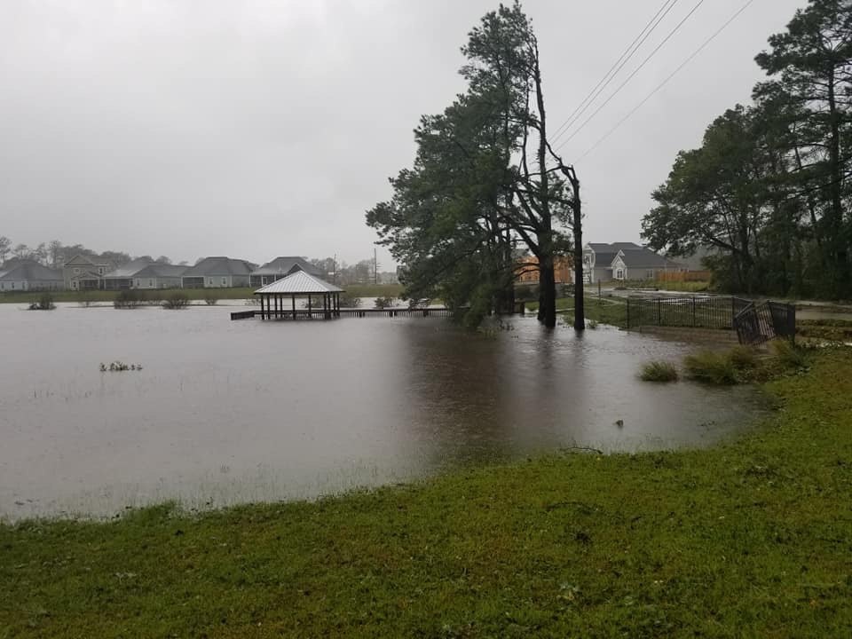
Then it stopped moving. Elizabethtown recorded 35.93 inches, a state record. Pender County flooded from the inside out, from rain and rivers rather than from the ocean. I-40 went under. Neighborhoods that had never taken water took water. People who stayed because it was “only a one” spent days cut off.
The Saffir-Simpson category measures wind. It tells you nothing about the rain, and around here the rain is what gets us.
What Has Actually Changed in the Rules
Pender County overhauled its Unified Development Ordinance in 2018, its first real update since the 1990s, and strengthened the stormwater section the same year. As codified, Section 7.9 caps post-development runoff at 10 percent above pre-development levels and requires subdivision drainage to handle the ten-year storm without flooding or substantial ponding. Those are real standards. They are also the floor, and a ten-year design standard is not a Florence standard.
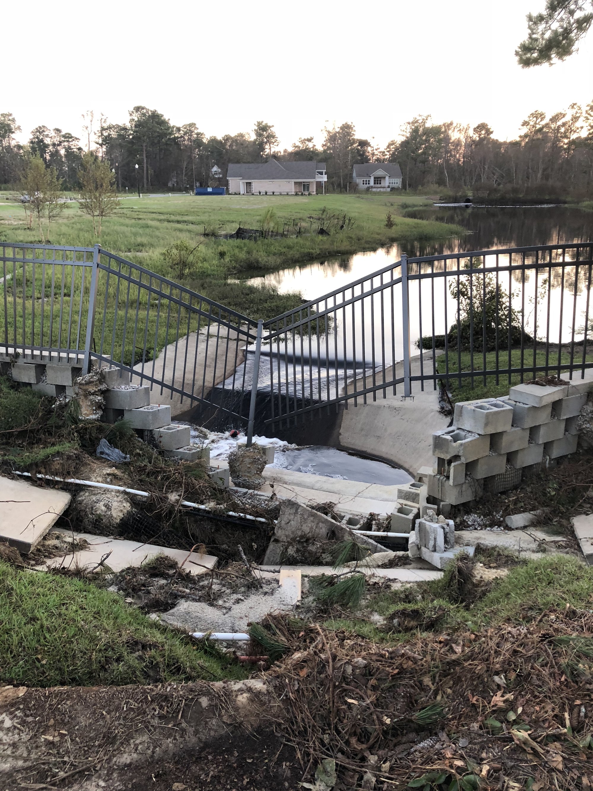
That is engineered stormwater infrastructure in a newer Hampstead subdivision, and Florence went around it.
The rules are still moving, too. In 2024 the county’s own planning staff filed a text amendment, ZTA 2024-25, to strike a single word from Section 7.9(D)(1)(i) so that a developer’s stormwater calculations would have to be submitted, where previously they were not required. The Planning Board heard it May 7, 2024 and it went to commissioners June 17, 2024. I have not been able to confirm the final vote as of Aug. 14, 2026, and I have a call in to Pender Planning at (910) 259-1202.
Meanwhile Pender grew from 60,203 people in 2020 to roughly 72,111 in 2025, with more than 5,100 housing units permitted since 2020. Hampstead is unincorporated. No town hall, no town public works crew, no municipal stormwater utility. Roads and drainage answer to the county and to NCDOT, and the ditch behind your lot may belong to an HOA, a developer, or nobody who will admit it. That is not an argument against growth. It is an argument for knowing which side of the ditch you are on before the rain starts.
What to Do Before School Starts
- Do the outdoor jobs at 7 a.m., not 3 p.m. Clear the culvert at the end of your driveway and trim what is going to come down. Both are worth doing, neither is worth a heat illness.
- Photograph every room, plus your ditches and culverts, while everything is dry. Time-stamped “before” photos settle claims.
- Look up your flood zone at msc.fema.gov/portal. “Not required” is not the same as “not at risk.” Much of the Florence flooding happened outside mapped zones.
- Buy flood insurance now if you are going to. NFIP policies carry a 30-day waiting period, so a policy bought once a storm is named does not cover that storm.
- Sign up for Pender County alerts and learn your evacuation zone. If you are renting, learn the zone your rental sits in. Evacuations are ordered by the county or the governor, not by the category.
- Refill the kit: water, medications, cash, a charged battery pack, and a plan for pets and for anyone who needs power for medical equipment.
Then go back to school shopping. The point is not to spend the fall anxious. It is to spend 90 minutes this weekend so that the second week of September is a logistics problem instead of a crisis.
Advertisement
Support local coverage: Topsail Guide is independently operated and supported by readers. If our stories and guides are useful, you can support the site here.
See something wrong? Report a correction or read our editorial standards.